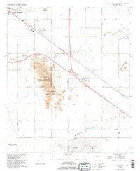
1992 Map of Casa Grande Mountains
USGS Topo · Published 1995About this map
Casa Grande Mountain Park and the adjacent Casa Grande Military Reservation anchor this landscape, surrounded by an extensive network of irrigation canals essential to Pinal County agriculture. These waterways, including the Hohokam Main Canal and the Santa Rosa Canal, crisscross the desert to reach the wide Santa Cruz Flats. Transportation and settlement patterns are defined by the Southern Pacific railroad corridor, which links the city of Casa Grande with smaller communities like Arizola and the planned residential layout of Arizona City. Local history is preserved in sites such as the Weaver Pioneer Cemetery and the Mountain View Cemetery, while the northern portion of the map shows established institutions like St Anthony Sch and Palo Verde Sch. To the east, the Toltec Buttes rise above the agricultural grid, marked by scattered prospects.
Find a feature on this map
31 named features on this map. Tap any name to fly to it.
Don’t see what you’re looking for? This feature index may not catch every label — zoom into the map to look around manually.
Map Details
Editions of this 1992 Casa Grande Mountains Map
This is the sole edition of this map. No revisions or reprints were ever made.
Other maps of this area

1922 · Casa Grande
USGS Topo · 1:62,500

1922 · Signal Peak
USGS Topo · 1:62,500

1924 · Signal Peak
USGS Topo · 1:62,500

1924 · Casa Grande
USGS Topo · 1:62,500

1942 · Silver Reef Mountains
USGS Topo · 1:62,500

1947 · Eloy
USGS Topo · 1:62,500

1948 · Eloy
USGS Topo · 1:62,500

1956 · Tucson
USGS Topo · 1:250,000

1958 · Tucson
USGS Topo · 1:250,000

1959 · Tucson
USGS Topo · 1:250,000