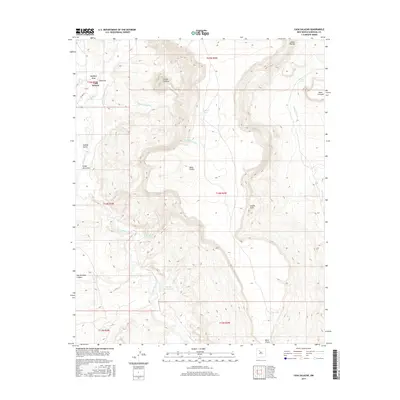
2017 Map of Casa Salazar
USGS Topo · Published 2017About this map
Casa Salazar sits within a landscape defined by the winding course of the Rio Puerco and the massive landforms of the Rio Puerco Valley. This 2017 survey captures a remote region of Sandoval County characterized by dramatic mesa topographies, including the prominent Mesa Prieta and Big Bead Mesa. The drainage patterns are clearly delineated, showing how Canada Gonzales and Arroyo Cuervo feed into the primary river system, while several livestock or water catchment features like Sam Hill Tank and Miguel Urrea Tank reflect the area's grazing history. The cartography provides a clear view of the complex terrain, from the heights of Squaw Peak to the depression of Dry Lake. Historically significant land divisions are noted across the quadrangle, which covers portions of townships T15N through T13N, revealing the underlying grid of this high-desert environment near the southern reaches of the San Juan Basin.
Find a feature on this map
26 named features on this map. Tap any name to fly to it.
Don’t see what you’re looking for? This feature index may not catch every label — zoom into the map to look around manually.
Map Details
Editions of this 2017 Casa Salazar Map
This is the sole edition of this map. No revisions or reprints were ever made.
Other maps of this area

1883 · Mt. Taylor
USGS Topo · 1:250,000

1886 · Mt. Taylor
USGS Topo · 1:250,000

1888 · Bernalillo
USGS Topo · 1:125,000

1889 · Albuquerque
USGS Topo · 1:125,000

1890 · Jemes
USGS Topo · 1:125,000

1892 · Jemes
USGS Topo · 1:125,000

1892 · Mt. Taylor
USGS Topo · 1:250,000

1893 · Albuquerque
USGS Topo · 1:125,000

1899 · Mt. Taylor
USGS Topo · 1:250,000

1939 · San Ysidro
USGS Topo · 1:62,500