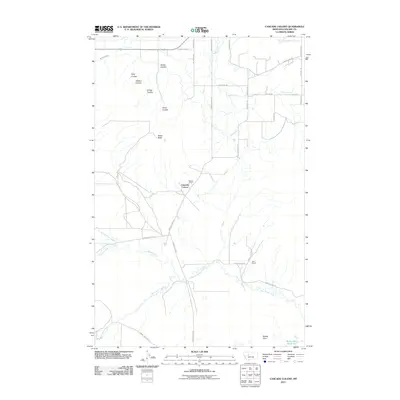
2011 Map of Cascade Colony
USGS Topo · Published 2011About this map
Cascade Colony and the neighboring Seaton Ranch define the communal and agricultural heart of this landscape in Cascade County. The terrain is deeply textured by a series of drainages and coulees, including Kolsta Coulee, Fjeld Coulee, and Prevo Coulee, which descend toward the larger water systems of the region. Significant water management and natural hydrology are evident in the presence of the Fort Shaw Canal in the northwest and the winding courses of Little Muddy Creek and Saint Johns Creek. These waterways, along with Rocky Reef Reservoir, support the ranching operations and agricultural life that have long characterized this part of Montana. From the prominent height of Shaw Butte to the low expanse of Muddy Flats, the map provides a look at the rural infrastructure and land use patterns of the early twenty-first century.
Find a feature on this map
29 named features on this map. Tap any name to fly to it.
Don’t see what you’re looking for? This feature index may not catch every label — zoom into the map to look around manually.
Map Details
Editions of this 2011 Cascade Colony Map
This is the sole edition of this map. No revisions or reprints were ever made.
Other maps of this area

1886 · Great Falls
USGS Topo · 1:250,000

1949 · Cascade
USGS Topo · 1:62,500

1949 · Vaughn
USGS Topo · 1:62,500

1950 · Fairfield
USGS Topo · 1:62,500

1951 · Cascade
USGS Topo · 1:62,500

1952 · Vaughn
USGS Topo · 1:62,500

1954 · Great Falls
USGS Topo · 1:250,000

1957 · Great Falls
USGS Topo · 1:250,000

1960 · Simms
USGS Topo · 1:62,500

1976 · Great Falls North
USGS Topo · 1:100,000