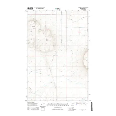
2014 Map of Cascade Colony
USGS Topo · Published 2014About this map
Fort Shaw and the Cascade Colony anchor this modern topographical study of the Montana plains, where the land is defined by complex drainage systems and irrigation infrastructure. The northern section is dominated by the Fort Shaw Canal and the Russell Lateral, supporting agriculture in this semi-arid environment. The terrain transitions from these managed waterways into a series of deeply etched coulees named for local families and natural features, including Fjeld Coulee, Hanson Coulee, and O'Neil Coulee. Prominent geological landmarks like Square Butte and Shaw Butte rise above the surrounding creek beds, while the southern reaches of the map follow the meandering paths of Little Muddy Cr and Saint Johns Cr toward Rocky Reef Reservoir. This 2014 survey documents the persistence of the Hutterite colony and the enduring rural road network that connects these isolated settlements.
Find a feature on this map
36 named features on this map. Tap any name to fly to it.
Don’t see what you’re looking for? This feature index may not catch every label — zoom into the map to look around manually.
Map Details
Editions of this 2014 Cascade Colony Map
This is the sole edition of this map. No revisions or reprints were ever made.
Other maps of this area

1886 · Great Falls
USGS Topo · 1:250,000

1949 · Cascade
USGS Topo · 1:62,500

1949 · Vaughn
USGS Topo · 1:62,500

1950 · Fairfield
USGS Topo · 1:62,500

1951 · Cascade
USGS Topo · 1:62,500

1952 · Vaughn
USGS Topo · 1:62,500

1954 · Great Falls
USGS Topo · 1:250,000

1957 · Great Falls
USGS Topo · 1:250,000

1960 · Simms
USGS Topo · 1:62,500

1976 · Great Falls North
USGS Topo · 1:100,000