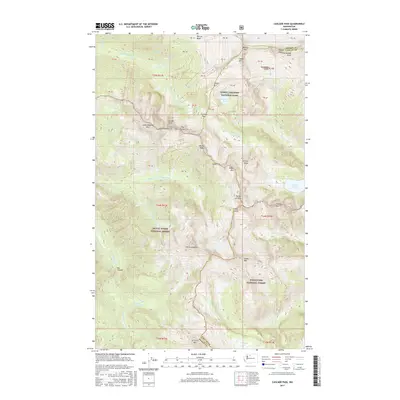
2017 Map of Cascade Pass
USGS Topo · Published 2017About this map
North Cascades National Park and the Mount Baker National Forest converge at Cascade Pass, a significant high-altitude crossing that divides the watersheds of the N Fork Cascade River and the Stehekin River. This 2017 survey details the complex alpine topography of the Skagit and Chelan county line, where high basins and cirques contain isolated water bodies like Doubtful Lake and Trapper Lake.
Find a feature on this map
71 named features on this map. Tap any name to fly to it.
Don’t see what you’re looking for? This feature index may not catch every label — zoom into the map to look around manually.
Map Details
Editions of this 2017 Cascade Pass Map
This is the sole edition of this map. No revisions or reprints were ever made.
Other maps of this area

1899 · Glacier Peak
USGS Topo · 1:125,000

1901 · Glacier Peak
USGS Topo · 1:125,000

1902 · Stehekin
USGS Topo · 1:125,000

1904 · Stehekin
USGS Topo · 1:125,000

1920 · Slate Pass
USGS Topo · 1:125,000

1955 · Concrete
USGS Topo · 1:250,000

1958 · Concrete
USGS Topo · 1:250,000

1962 · Concrete
USGS Topo · 1:250,000
1963 · Agnes Mtn
USGS Topo · 1:24,000

1963 · Sonny Boy Lakes
USGS Topo · 1:24,000