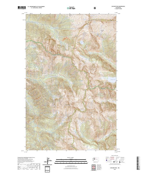
2023 Map of Cascade Pass
USGS Topo · Published 2023About this map
Cascade Pass serves as the focal point of this high-elevation survey at the crest of the Washington Cascades, marking the divide between the Skagit and Chelan county lines. The landscape is defined by its dramatic verticality, where the North-Fork Cascade River and Middle Fork Cascade River drain steep basins beneath massive peaks. Glacial activity is prominent throughout the terrain, evidenced by the Sahale Glacier, Spider Glacier, and Middle Cascade Glacier, which cling to the high ridges of Ripsaw Ridge and peaks like Mt Formidable.
Find a feature on this map
78 named features on this map. Tap any name to fly to it.
Don’t see what you’re looking for? This feature index may not catch every label — zoom into the map to look around manually.
Map Details
Editions of this 2023 Cascade Pass Map
This is the sole edition of this map. No revisions or reprints were ever made.
Other maps of this area

1899 · Glacier Peak
USGS Topo · 1:125,000

1901 · Glacier Peak
USGS Topo · 1:125,000

1902 · Stehekin
USGS Topo · 1:125,000

1904 · Stehekin
USGS Topo · 1:125,000

1920 · Slate Pass
USGS Topo · 1:125,000

1955 · Concrete
USGS Topo · 1:250,000

1958 · Concrete
USGS Topo · 1:250,000

1962 · Concrete
USGS Topo · 1:250,000
1963 · Agnes Mtn
USGS Topo · 1:24,000

1963 · Sonny Boy Lakes
USGS Topo · 1:24,000