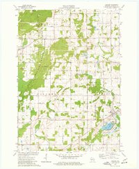
1974 Map of Cascade
USGS Topo · Published 1977About this map
The glacial topography of the Kettle Moraine State Forest dominates this Sheboygan County landscape, featuring distinctive geological formations like the Greenbush Kettle and the winding Parnell Esker. In the mid-1970s, the village of Cascade sits along the banks of Cascade Creek near Lake Ellen, serving as a focal point for the surrounding townships of Lyndon and Mitchell. The map documents a blend of conservation and local heritage, showing the Nichols Creek State Wildlife Area alongside several country burial grounds including St Pauls Cem and Mt Pleasant Cem. At Parnell, the Parnell Observation Tower offers a vantage point over the ridges and summits that define this section of the Moraine. The network of rural routes like Hickory Grove Road and Ridge Road connects small settlements such as German Corners, reflecting the area's transition from agricultural utility to a regional recreational destination.
Find a feature on this map
56 named features on this map. Tap any name to fly to it.
Don’t see what you’re looking for? This feature index may not catch every label — zoom into the map to look around manually.
Map Details
Editions of this 1974 Cascade Map
2 editions found
Other maps of this area

1954 · Sheboygan Falls
USGS Topo · 1:62,500

1954 · Howards Grove
USGS Topo · 1:62,500

1954 · Franklin
USGS Topo · 1:24,000

1954 · Kiel
USGS Topo · 1:62,500

1954 · Milwaukee
USGS Topo · 1:250,000

1955 · Kewaskum
USGS Topo · 1:62,500

1957 · Madison
USGS Topo · 1:250,000

1958 · Milwaukee
USGS Topo · 1:250,000

1960 · Madison
USGS Topo · 1:250,000
1974 · Random Lake
USGS Topo · 1:24,000