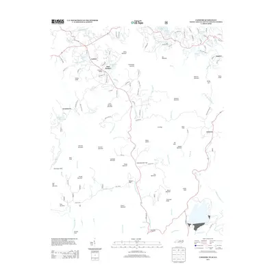
2013 Map of Cashiers
USGS Topo · Published 2013About this map
Cashiers serves as the central hub for this high-elevation landscape where the Chattooga River and the Horsepasture River drain the surrounding heights. The map records a mix of long-standing mountain settlements and modern recreational development, evidenced by the presence of Cliffs Condominiums near Fairfield Lake and the established grounds of High Hampton. To the south, the topography descends toward Ellicott Rock, a significant survey marker where North Carolina, South Carolina, and Georgia meet. The road network, including State HWY 107 and Slab Town RD, links isolated gaps and hollows like Heady Mountain Gap and Happy Hollow. Genealogists and local historians can trace family-named terrain such as Waddle Mountain and Mccall RD alongside the numerous small mountain lakes like Sapphire Lake and Hampton Lake that define the region's character.
Find a feature on this map
122 named features on this map. Tap any name to fly to it.
Don’t see what you’re looking for? This feature index may not catch every label — zoom into the map to look around manually.
Map Details
Editions of this 2013 Cashiers Map
This is the sole edition of this map. No revisions or reprints were ever made.
Other maps of this area

1886 · Walhalla
USGS Topo · 1:125,000

1888 · Pickens
USGS Topo · 1:125,000

1891 · Cowee
USGS Topo · 1:125,000

1892 · Walhalla
USGS Topo · 1:125,000

1894 · Pickens
USGS Topo · 1:125,000

1896 · Walhalla
USGS Topo · 1:125,000

1897 · Cowee
USGS Topo · 1:125,000

1905 · Pisgah
USGS Topo · 1:125,000

1906 · Pisgah
USGS Topo · 1:125,000

1907 · Cowee
USGS Topo · 1:125,000