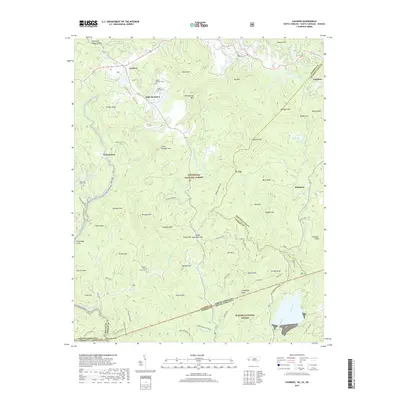
2019 Map of Cashiers
USGS Topo · Published 2019About this map
Cashiers Valley forms the heart of this high-elevation mountain landscape, where the Tennessee Valley Divide splits the waters flowing toward the Atlantic and the Gulf. In the north, the settlement of Cashiers sits near Cashiers Lake, while the resort community of High Hampton lies adjacent to Hampton Lake. The terrain is defined by dramatic peaks and ridges including Chimneytop Mtn and Sassafras Mtn, dropping sharply into the Nantahala National Forest and Sumter National Forest. Local history is preserved in small burial grounds like Upper Zachary Cem and Norton Cem, as well as the Pleasant Grove Church. The region is a hydrologic crossroads, with the headwaters of the Horsepasture River and the Whitewater River carving steep paths through gaps such as Heady Mountain Gap and Mulkey Gap.
Find a feature on this map
90 named features on this map. Tap any name to fly to it.
Don’t see what you’re looking for? This feature index may not catch every label — zoom into the map to look around manually.
Map Details
Editions of this 2019 Cashiers Map
This is the sole edition of this map. No revisions or reprints were ever made.
Other maps of this area

1886 · Walhalla
USGS Topo · 1:125,000

1888 · Pickens
USGS Topo · 1:125,000

1891 · Cowee
USGS Topo · 1:125,000

1892 · Walhalla
USGS Topo · 1:125,000

1894 · Pickens
USGS Topo · 1:125,000

1896 · Walhalla
USGS Topo · 1:125,000

1897 · Cowee
USGS Topo · 1:125,000

1905 · Pisgah
USGS Topo · 1:125,000

1906 · Pisgah
USGS Topo · 1:125,000

1907 · Cowee
USGS Topo · 1:125,000