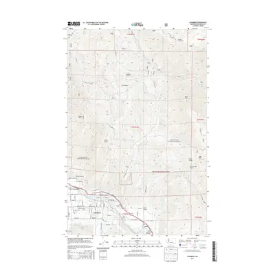
2014 Map of Cashmere
USGS Topo · Published 2014About this map
The town of Cashmere is the focal point of this survey, positioned at the confluence of Mission Cr and the Wenatchee River. The valley floor is defined by a complex network of agricultural and transport infrastructure, including the Icicle Canal, the Cashmere-Dryden Airport, and numerous local roads like Blue Star Rd and Pioneer Ave. Just north of the river, the landscape rises sharply into the Entiat Mountains and is carved by deep drainages such as Nahahum Canyon and Hay Canyon. High peaks like Tibbetts Mtn and Burch Mtn overlook the transition from the settled riverfront to the protected lands of the Wenatchee National Forest. Historical researchers will note the location of the Cashmere Cem and the various bridges, including the West Monitor Bridge and Goodwin Road Bridge, which signify the critical crossing points for this river-centered community.
Find a feature on this map
67 named features on this map. Tap any name to fly to it.
Don’t see what you’re looking for? This feature index may not catch every label — zoom into the map to look around manually.
Map Details
Editions of this 2014 Cashmere Map
This is the sole edition of this map. No revisions or reprints were ever made.
Other maps of this area

1897 · Mount Stuart
USGS Topo · 1:125,000

1901 · Chelan
USGS Topo · 1:125,000

1901 · Chiwaukum
USGS Topo · 1:125,000

1902 · Mount Stuart
USGS Topo · 1:125,000

1904 · Chiwaukum
USGS Topo · 1:125,000

1913 · Wenatchee
USGS Topo · 1:62,500

1915 · Wenatchee
USGS Topo · 1:62,500

1920 · Colockum Pass
USGS Topo · 1:125,000

1922 · Colockum Pass
USGS Topo · 1:125,000

1957 · Wenatchee
USGS Topo · 1:250,000