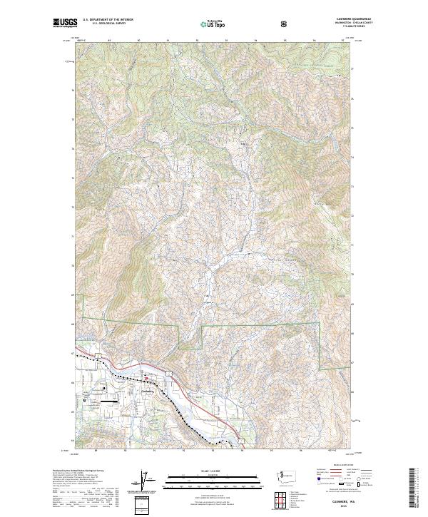
2023 Map of Cashmere
USGS Topo · Published 2023About this map
Cashmere occupies a strategic bend in the Wenatchee River, where the valley floor transitions into the steep slopes of the Entiat Mountains. The complex network of water management features, including the Icicle Canal, Peshastin Ditch, and High Line Canal, illustrates the critical importance of irrigation to this central Washington region. The settlement is anchored by a dense grid of residential streets like Pioneer Ave and Cottage Ave, while the surrounding landscape is marked by the deep incisions of Nahahum Canyon and Derby Canyon. For genealogists, the map identifies several distinct burial grounds, including the Cashmere Cem, Brisk Cemetery, and Treadwell Cem. The northern portion of the quadrangle is dominated by the protected lands of the Wenatchee National Forest, rising toward peaks such as Burch Mtn and Tibbetts Mtn.
Find a feature on this map
70 named features on this map. Tap any name to fly to it.
Don’t see what you’re looking for? This feature index may not catch every label — zoom into the map to look around manually.
Map Details
Editions of this 2023 Cashmere Map
This is the sole edition of this map. No revisions or reprints were ever made.
Other maps of this area

1897 · Mount Stuart
USGS Topo · 1:125,000

1901 · Chelan
USGS Topo · 1:125,000

1901 · Chiwaukum
USGS Topo · 1:125,000

1902 · Mount Stuart
USGS Topo · 1:125,000

1904 · Chiwaukum
USGS Topo · 1:125,000

1913 · Wenatchee
USGS Topo · 1:62,500

1915 · Wenatchee
USGS Topo · 1:62,500

1920 · Colockum Pass
USGS Topo · 1:125,000

1922 · Colockum Pass
USGS Topo · 1:125,000

1957 · Wenatchee
USGS Topo · 1:250,000