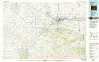
1979 Map of Casper
USGS Topo · Published 1980About this map
Casper sits at the northern base of the Laramie Mountains, serving as a central hub for the energy and ranching lands of Natrona County. In this late 1970s landscape, the North Platte River winds northwest through the city, flanked by industrial developments and transport corridors like the Chicago and North Western and Burlington Northern railroads. To the south, Casper Mountain rises sharply, featuring recreational areas such as Casper Mountain County Park.
Find a feature on this map
65 named features on this map. Tap any name to fly to it.
Don’t see what you’re looking for? This feature index may not catch every label — zoom into the map to look around manually.
Map Details
Editions of this 1979 Casper Map
This is the sole edition of this map. No revisions or reprints were ever made.
Other maps of this area

1949 · Brookhurst
USGS Topo · 1:24,000

1949 · Campbell Hill
USGS Topo · 1:24,000

1949 · Parkerton
USGS Topo · 1:24,000

1949 · Glenrock NW
USGS Topo · 1:24,000

1949 · Pratts Soda Lakes
USGS Topo · 1:24,000

1950 · Campbell Hill
USGS Topo · 1:24,000

1950 · Lockett
USGS Topo · 1:24,000

1950 · Brookhurst
USGS Topo · 1:24,000

1950 · Parkerton
USGS Topo · 1:24,000

1950 · Glenrock NW
USGS Topo · 1:24,000