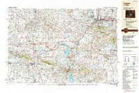
1988 Map of Casper
USGS Topo · Published 1988About this map
The North Platte River carves a critical path through this expansive Wyoming landscape, anchoring the regional hub of Casper and its neighboring communities like Mills and Evansville. By the late 1980s, the area's complex water management system is clearly defined by the massive Pathfinder Reservoir, Seminoe Reservoir, and Alcova Reservoir, which support both agricultural irrigation and recreation at Seminoe State Park. The geography is defined by a series of dramatic uplifts, including the Laramie Mountains, Ferris Mountains, and the Shirley Mountains, which hem in the high-altitude Shirley Basin.
Find a feature on this map
53 named features on this map. Tap any name to fly to it.
Don’t see what you’re looking for? This feature index may not catch every label — zoom into the map to look around manually.
Map Details
Editions of this 1988 Casper Map
This is the sole edition of this map. No revisions or reprints were ever made.
Other maps of this area

1893 · Fort Steele
USGS Topo · 1:125,000

1914 · Hanna
USGS Topo · 1:62,500

1914 · Walcott
USGS Topo · 1:62,500

1914 · Saddleback Hills
USGS Topo · 1:62,500

1915 · Como Ridge
USGS Topo · 1:48,000

1918 · Como Ridge
USGS Topo · 1:62,500

1921 · Saddleback Hills
USGS Topo · 1:62,500

1949 · Brookhurst
USGS Topo · 1:24,000

1949 · Campbell Hill
USGS Topo · 1:24,000

1949 · Parkerton
USGS Topo · 1:24,000