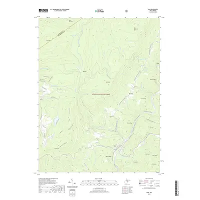
2019 Map of Cass
USGS Topo · Published 2019About this map
Cass serves as a focal point in this high-altitude landscape of the Monongahela National Forest, where the waters of the Greenbrier River and Deer Creek converge. The terrain is defined by massive parallel ridges, most notably Cheat Mtn and Back Allegheny Mtn, with Bald Knob rising as a prominent high point. This 2019 survey documents the complex network of trails and forestry roads that thread through the timberland, including the Allegheny Trail and the Shavers Lake Trail. Smaller settlements like Wanless and the high-elevation site at Spruce are situated along these waterways and ridgelines. Local history is anchored by sites such as Wanless Cem and Hilltop Cem, while the inclusion of the Airport Runway and names like Enchanted Forest point to the area's modern role in recreation and wilderness management.
Find a feature on this map
63 named features on this map. Tap any name to fly to it.
Don’t see what you’re looking for? This feature index may not catch every label — zoom into the map to look around manually.
Map Details
Editions of this 2019 Cass Map
This is the sole edition of this map. No revisions or reprints were ever made.
Other maps of this area

1889 · Beverly
USGS Topo · 1:125,000

1891 · Huntersville
USGS Topo · 1:125,000

1892 · Beverly
USGS Topo · 1:125,000

1893 · Buckhannon
USGS Topo · 1:125,000

1894 · Huntersville
USGS Topo · 1:125,000

1896 · Buckhannon
USGS Topo · 1:125,000

1897 · Buckhannon
USGS Topo · 1:125,000

1901 · Monterey
USGS Topo · 1:125,000

1913 · Pickens
USGS Topo · 1:48,000

1915 · Pickens
USGS Topo · 1:62,500