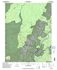
1995 Map of Cass
USGS Topo · Published 1998About this map
Cass Scenic Railroad operations define the movement through this high-altitude corridor of the Allegheny Mountains in the mid-1990s. The map illustrates the specialized infrastructure of the logging-turned-heritage line, including the Scenic Railroad Grade and Whittaker Station, climbing toward Bald Knob. To the west, the Snowshoe Ski Area marks a shift toward modern recreation, with ski lift lines and water tanks situated atop Thorny Flat.
Find a feature on this map
57 named features on this map. Tap any name to fly to it.
Don’t see what you’re looking for? This feature index may not catch every label — zoom into the map to look around manually.
Map Details
Editions of this 1995 Cass Map
This is the sole edition of this map. No revisions or reprints were ever made.
Other maps of this area

1889 · Beverly
USGS Topo · 1:125,000

1891 · Huntersville
USGS Topo · 1:125,000

1892 · Beverly
USGS Topo · 1:125,000

1893 · Buckhannon
USGS Topo · 1:125,000

1894 · Huntersville
USGS Topo · 1:125,000

1896 · Buckhannon
USGS Topo · 1:125,000

1897 · Buckhannon
USGS Topo · 1:125,000

1901 · Monterey
USGS Topo · 1:125,000

1913 · Pickens
USGS Topo · 1:48,000

1915 · Pickens
USGS Topo · 1:62,500