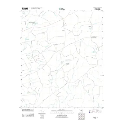
2011 Map of Cassatt
USGS Topo · Published 2011About this map
The unincorporated community of Cassatt serves as the focal point of this landscape, situated at the junction of several historic transit corridors including Old Stagecoach Rd and Old Camden Rd. The area is defined by a dense hydrological network feeding into the Wateree River basin, marked by numerous millponds that speak to a legacy of water-powered industry. West Millpond, Llewellyn Millpond, and Ratcliff Millpond illustrate the historical importance of controlling local waterways like Big Pine Tree Creek and Timber Creek.
Find a feature on this map
96 named features on this map. Tap any name to fly to it.
Don’t see what you’re looking for? This feature index may not catch every label — zoom into the map to look around manually.
Map Details
Editions of this 2011 Cassatt Map
This is the sole edition of this map. No revisions or reprints were ever made.
Other maps of this area

1935 · Camden
USGS Topo · 1:48,000

1938 · Camden
USGS Topo · 1:62,500

1938 · Hagood
USGS Topo · 1:62,500

1941 · Spartanburg
USGS Topo · 1:250,000

1942 · Camden
USGS Topo · 1:125,000

1953 · Camden South
USGS Topo · 1:24,000

1953 · Spartanburg
USGS Topo · 1:250,000

1957 · Ashwood
USGS Topo · 1:62,500

1960 · Spartanburg
USGS Topo · 1:250,000

1963 · Spartanburg
USGS Topo · 1:250,000