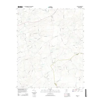
2014 Map of Cassatt
USGS Topo · Published 2014About this map
The settlement of Cassatt serves as the focal point for this 2014 survey of the South Carolina sandhills. The landscape is defined by an extensive network of water bodies and millponds, suggesting a long history of water-powered industry and rural homesteads. Significant features like Llewellyn Millpond, West Millpond, and Ratliff Millpond punctuate the drainage basins of Big Pine Tree Cr and Black Cr. To the southeast, the Kershaw Co and Lee Co line cuts through the terrain near the Lockhart Cem, providing a precise reference point for genealogists and local historians tracking family properties. A complex web of secondary roads and older routes, such as Old Stagecoach Rd and Cantey Hill Rd, weave between these creeks and ponds, revealing the established settlement patterns that persisted into the early 21st century.
Find a feature on this map
93 named features on this map. Tap any name to fly to it.
Don’t see what you’re looking for? This feature index may not catch every label — zoom into the map to look around manually.
Map Details
Editions of this 2014 Cassatt Map
This is the sole edition of this map. No revisions or reprints were ever made.
Other maps of this area

1935 · Camden
USGS Topo · 1:48,000

1938 · Camden
USGS Topo · 1:62,500

1938 · Hagood
USGS Topo · 1:62,500

1941 · Spartanburg
USGS Topo · 1:250,000

1942 · Camden
USGS Topo · 1:125,000

1953 · Camden South
USGS Topo · 1:24,000

1953 · Spartanburg
USGS Topo · 1:250,000

1957 · Ashwood
USGS Topo · 1:62,500

1960 · Spartanburg
USGS Topo · 1:250,000

1963 · Spartanburg
USGS Topo · 1:250,000