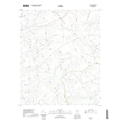
2020 Map of Cassatt
USGS Topo · Published 2020About this map
The unincorporated community of Cassatt sits at the northern edge of this Kershaw County landscape, defined by a network of creeks and man-made impoundments. The geography is shaped by water, with Llewellyn Millpond, West Millpond, and Ratliff Millpond indicating a history of milling along the numerous branches and creeks. Big Pine Tree Cr and Black Cr drain the sandy terrain, which is intersected by routes that hint at the region's long-standing transportation corridors, such as Old Stagecoach Rd and Old Wire Rd. These thoroughfares suggest early mail and travel routes that predated modern paving. To the southeast, the Kershaw County and Lee County line cuts through the drainages of Pates Mill Br and Fuzzy Br. Significant for local historians and genealogists, the Lockard Cemetery remains a documented landmark in the southeastern corner, while family names like Baskin, Ratliff, and Reynolds are preserved in the local road network.
Find a feature on this map
94 named features on this map. Tap any name to fly to it.
Don’t see what you’re looking for? This feature index may not catch every label — zoom into the map to look around manually.
Map Details
Editions of this 2020 Cassatt Map
This is the sole edition of this map. No revisions or reprints were ever made.
Other maps of this area

1935 · Camden
USGS Topo · 1:48,000

1938 · Camden
USGS Topo · 1:62,500

1938 · Hagood
USGS Topo · 1:62,500

1941 · Spartanburg
USGS Topo · 1:250,000

1942 · Camden
USGS Topo · 1:125,000

1953 · Camden South
USGS Topo · 1:24,000

1953 · Spartanburg
USGS Topo · 1:250,000

1957 · Ashwood
USGS Topo · 1:62,500

1960 · Spartanburg
USGS Topo · 1:250,000

1963 · Spartanburg
USGS Topo · 1:250,000