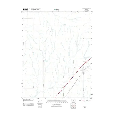
2012 Map of Cassoday
USGS Topo · Published 2012About this map
Cassoday serves as the primary settlement on this 2012 Butler County map, situated at the intersection of local routes like E Main St and N Kansas St. The landscape is defined by the drainage of the Walnut River, which is joined by several tributaries including Brush Cr, Middle Cr, and School Br. These waterways cut through a rural landscape organized by a rigid grid of country roads, such as NE Munson Hill Rd and NE Sycamore Springs Rd. Just north of the town center lies the Cassoday Cem, a significant point for genealogical research. The map illustrates the contemporary configuration of this Kansas prairie community, showing the spatial relationship between the town core and the surrounding agricultural land before any subsequent 21st-century developments.
Find a feature on this map
23 named features on this map. Tap any name to fly to it.
Don’t see what you’re looking for? This feature index may not catch every label — zoom into the map to look around manually.
Map Details
Editions of this 2012 Cassoday Map
This is the sole edition of this map. No revisions or reprints were ever made.
Other maps of this area

1888 · Eldorado
USGS Topo · 1:125,000

1898 · Cottonwood Falls
USGS Topo · 1:125,000

1955 · Wichita
USGS Topo · 1:250,000

1955 · Hutchinson
USGS Topo · 1:250,000

1957 · Wonsevu
USGS Topo · 1:24,000

1958 · Wichita
USGS Topo · 1:250,000

1959 · Hutchinson
USGS Topo · 1:250,000

1961 · De Graff
USGS Topo · 1:24,000

1961 · Rosalia NE
USGS Topo · 1:24,000
1961 · Rosalia NW
USGS Topo · 1:24,000