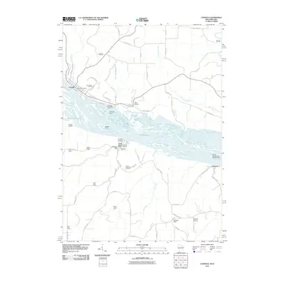
2010 Map of Cassville
USGS Topo · Published 2010About this map
The Mississippi River carves a deep valley through the Driftless Area, defining the border between Wisconsin and Iowa. On the eastern bank, the village of Cassville sits beneath the bluffs of Dietrich Heights, where the Cassville Post Office and Saint Charles Cemetery anchor the local community. Across the water, the settlement of North Buena Vista is perched above the river, accompanied by its own North Buena Vista Post Office and several rural landmarks such as Immaculate Conception Cemetery and Buena Vista Cemetery.
Find a feature on this map
66 named features on this map. Tap any name to fly to it.
Don’t see what you’re looking for? This feature index may not catch every label — zoom into the map to look around manually.
Map Details
Editions of this 2010 Cassville Map
This is the sole edition of this map. No revisions or reprints were ever made.
Other maps of this area

1900 · Lancaster
USGS Topo · 1:125,000

1902 · Elkader
USGS Topo · 1:125,000

1904 · Lancaster
USGS Topo · 1:125,000

1908 · Lancaster
USGS Topo · 1:125,000

1955 · Cassville
USGS Topo · 1:24,000

1955 · Balltown
USGS Topo · 1:24,000

1956 · Sherrill
USGS Topo · 1:24,000

1957 · Turkey River
USGS Topo · 1:24,000

1957 · Holy Cross
USGS Topo · 1:24,000

1959 · Dubuque
USGS Topo · 1:250,000