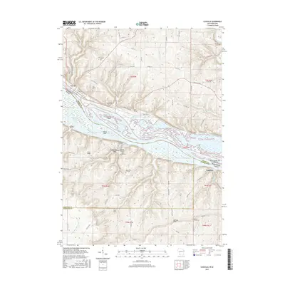
2016 Map of Cassville
USGS Topo · Published 2016About this map
The Mississippi River forms the central character of this riverine landscape, where the state boundaries of Wisconsin and Iowa meet amidst a complex network of channels and backwaters. Steep bluffs rise from the water's edge, housing the settlement of Cassville on the Wisconsin side and North Buena Vista across the river in Iowa. This area is defined by its dramatic relief, with named heights like Hefel Ridge and Sugar Loaf overlooking the river valley.
Find a feature on this map
90 named features on this map. Tap any name to fly to it.
Don’t see what you’re looking for? This feature index may not catch every label — zoom into the map to look around manually.
Map Details
Editions of this 2016 Cassville Map
This is the sole edition of this map. No revisions or reprints were ever made.
Other maps of this area

1900 · Lancaster
USGS Topo · 1:125,000

1902 · Elkader
USGS Topo · 1:125,000

1904 · Lancaster
USGS Topo · 1:125,000

1908 · Lancaster
USGS Topo · 1:125,000

1955 · Cassville
USGS Topo · 1:24,000

1955 · Balltown
USGS Topo · 1:24,000

1956 · Sherrill
USGS Topo · 1:24,000

1957 · Turkey River
USGS Topo · 1:24,000

1957 · Holy Cross
USGS Topo · 1:24,000

1959 · Dubuque
USGS Topo · 1:250,000