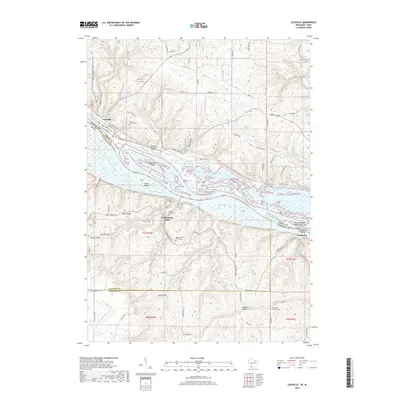
2018 Map of Cassville
USGS Topo · Published 2018About this map
Cassville sits along the northeastern bank of the Mississippi River in this 2018 survey, where the river's complex braided channels create a maze of islands and sloughs. The geography here is defined by significant elevation changes between the river valley and high ridges such as Hefel Ridge and Balltown Ridge. The map details the cross-river relationship between Wisconsin and Iowa, showing the settlements of North Buena Vista and Waupeton on the southwestern shore.
Find a feature on this map
80 named features on this map. Tap any name to fly to it.
Don’t see what you’re looking for? This feature index may not catch every label — zoom into the map to look around manually.
Map Details
Editions of this 2018 Cassville Map
This is the sole edition of this map. No revisions or reprints were ever made.
Other maps of this area

1900 · Lancaster
USGS Topo · 1:125,000

1902 · Elkader
USGS Topo · 1:125,000

1904 · Lancaster
USGS Topo · 1:125,000

1908 · Lancaster
USGS Topo · 1:125,000

1955 · Cassville
USGS Topo · 1:24,000

1955 · Balltown
USGS Topo · 1:24,000

1956 · Sherrill
USGS Topo · 1:24,000

1957 · Turkey River
USGS Topo · 1:24,000

1957 · Holy Cross
USGS Topo · 1:24,000

1959 · Dubuque
USGS Topo · 1:250,000