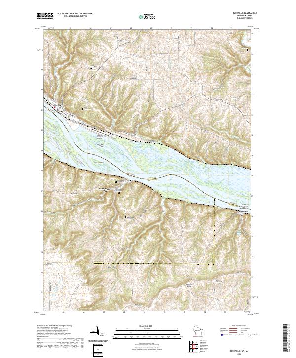
2022 Map of Cassville
USGS Topo · Published 2022About this map
The Mississippi River creates a complex landscape of islands and side channels at the intersection of Wisconsin and Iowa. On the Wisconsin shore, Cassville serves as a primary hub, featuring the Cassville Car Ferry and Cassville Municipal Airport. The river here is fragmented by large landforms such as Sweezy Island and Jack Oak Island, which are separated from the mainland by Picayune Chute and Crooked Slough.
Find a feature on this map
88 named features on this map. Tap any name to fly to it.
Don’t see what you’re looking for? This feature index may not catch every label — zoom into the map to look around manually.
Map Details
Editions of this 2022 Cassville Map
This is the sole edition of this map. No revisions or reprints were ever made.
Other maps of this area

1900 · Lancaster
USGS Topo · 1:125,000

1902 · Elkader
USGS Topo · 1:125,000

1904 · Lancaster
USGS Topo · 1:125,000

1908 · Lancaster
USGS Topo · 1:125,000

1955 · Cassville
USGS Topo · 1:24,000

1955 · Balltown
USGS Topo · 1:24,000

1956 · Sherrill
USGS Topo · 1:24,000

1957 · Turkey River
USGS Topo · 1:24,000

1957 · Holy Cross
USGS Topo · 1:24,000

1959 · Dubuque
USGS Topo · 1:250,000