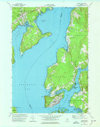
1973 Map of Castine
USGS Topo · Published 1977About this map
Castine occupies the tip of a peninsula at the meeting of the Penobscot River and the Bagaduce River, showing a landscape defined by maritime history and fortification. The street plan of the village reveals the presence of the Maritime Academy and the earthworks of Ft George, while the narrow British Canal cuts across the neck of the peninsula near Wadsworth Cove. This survey documents a complex shoreline where historical naval importance meets 20th-century coastal life, marked by tidal flats and numerous coves.
Find a feature on this map
75 named features on this map. Tap any name to fly to it.
Don’t see what you’re looking for? This feature index may not catch every label — zoom into the map to look around manually.
Map Details
Editions of this 1973 Castine Map
3 editions found
Other maps of this area

1900 · Orland
USGS Topo · 1:62,500

1900 · Bucksport
USGS Topo · 1:62,500

1902 · Bucksport
USGS Topo · 1:62,500

1902 · Castine
USGS Topo · 1:62,500

1904 · Castine
USGS Topo · 1:62,500

1904 · Bluehill
USGS Topo · 1:62,500

1905 · Penobscot Bay
USGS Topo · 1:125,000

1941 · Castine
USGS Topo · 1:62,500

1942 · Orland
USGS Topo · 1:62,500

1942 · Bucksport
USGS Topo · 1:62,500