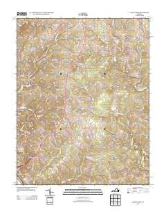
2013 Map of Castle Craig
USGS Topo · Published 2013About this map
Kingston and the surrounding agricultural lands of Campbell County are documented here during a period of steady residential infill. The landscape is defined by the dendritic drainage of several prominent waterways, including Troublesome Cr and Seneca Cr, which have historically dictated the placement of local thoroughfares. The road network reflects centuries of development, with names like Masons Mill Rd and Browns Mill Rd preserving the memory of early industry along the creeks.
Find a feature on this map
99 named features on this map. Tap any name to fly to it.
Don’t see what you’re looking for? This feature index may not catch every label — zoom into the map to look around manually.
Map Details
Editions of this 2013 Castle Craig Map
This is the sole edition of this map. No revisions or reprints were ever made.
Other maps of this area

1892 · Lynchburg
USGS Topo · 1:125,000

1944 · Lynchburg
USGS Topo · 1:62,500

1947 · Roanoke
USGS Topo · 1:250,000

1950 · Goode
USGS Topo · 1:62,500

1950 · Lynchburg
USGS Topo · 1:62,500

1951 · Altavista
USGS Topo · 1:62,500

1956 · Gladys
USGS Topo · 1:62,500

1959 · Roanoke
USGS Topo · 1:250,000

1963 · Roanoke
USGS Topo · 1:250,000

1963 · City Farm
USGS Topo · 1:24,000