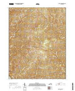
2019 Map of Castle Craig
USGS Topo · Published 2019About this map
The Big Otter River defines the southwestern corner of this landscape, just as it passes the community of Altavista. Moving north along the corridor of Wards Rd, the terrain transitions into a dense network of creek valleys and ridges that characterize this part of Campbell Co. The map documents established settlements such as Kingston and the community of Castle Craig, while providing a clear view of the residential development spreading through neighborhoods like those found off Crescent Hill Dr and Ridgewood Cir.
Find a feature on this map
91 named features on this map. Tap any name to fly to it.
Don’t see what you’re looking for? This feature index may not catch every label — zoom into the map to look around manually.
Map Details
Editions of this 2019 Castle Craig Map
This is the sole edition of this map. No revisions or reprints were ever made.
Other maps of this area

1892 · Lynchburg
USGS Topo · 1:125,000

1944 · Lynchburg
USGS Topo · 1:62,500

1947 · Roanoke
USGS Topo · 1:250,000

1950 · Goode
USGS Topo · 1:62,500

1950 · Lynchburg
USGS Topo · 1:62,500

1951 · Altavista
USGS Topo · 1:62,500

1956 · Gladys
USGS Topo · 1:62,500

1959 · Roanoke
USGS Topo · 1:250,000

1963 · Roanoke
USGS Topo · 1:250,000

1963 · City Farm
USGS Topo · 1:24,000