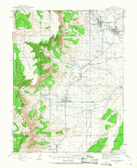
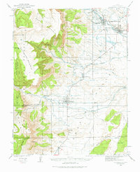
1923 Map of Castle Dale
USGS Topo · Published 1968About this map
Agricultural life in central Utah centered on the irrigation of arid lands during the early 1920s, as seen in this survey of the San Rafael Swell area. Small Mormon settlements like Orangeville and Castle Dale are positioned along Cottonwood Creek, where a network of irrigation works including Ditch and Cut Ditch helped sustain local farming. The presence of the Ferron Mill and several family-named outfits, such as Peterson Ranch and Larson Ranch, underscores the self-sufficient ranching economy of the era.
Find a feature on this map
44 named features on this map. Tap any name to fly to it.
Don’t see what you’re looking for? This feature index may not catch every label — zoom into the map to look around manually.
Map Details
Editions of this 1923 Castle Dale Map
3 editions found
Other maps of this area

1885 · San Rafael
USGS Topo · 1:250,000

1885 · Manti
USGS Topo · 1:250,000

1885 · Fish Lake
USGS Topo · 1:250,000

1886 · Price River
USGS Topo · 1:250,000

1895 · Manti
USGS Topo · 1:250,000

1896 · Price River
USGS Topo · 1:250,000

1896 · Fish Lake
USGS Topo · 1:250,000

1922 · Wasatch
USGS Topo · 1:31,680

1923 · Castle Dale
USGS Topo · 1:62,500

1923 · Hiawatha
USGS Topo · 1:62,500