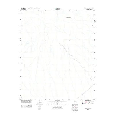
2012 Map of Castle Dome
USGS Topo · Published 2012About this map
Castle Dome rises as a prominent landmark in this desert region of San Bernardino County, where the topography is defined by the eastern reaches of the Clipper Mountains. The landscape is a network of ephemeral drainages, most notably Clipper Wash, which illustrates the arid hydrological patterns typical of the Mojave. This area is bisected by the iconic National Trails Hwy, the historic successor to the early automotive trails that connected the coast to the interior. The presence of Danby Rd further suggests the legacy of desert passage and ranching access in an area where vertical relief and dry washes dictate movement and land use. The map offers a precise view of the terrain before more modern infrastructure or changes to the desert protected areas might have altered the visible access points.
Find a feature on this map
5 named features on this map. Tap any name to fly to it.
Don’t see what you’re looking for? This feature index may not catch every label — zoom into the map to look around manually.
Map Details
Editions of this 2012 Castle Dome Map
This is the sole edition of this map. No revisions or reprints were ever made.
Other maps of this area

1942 · Amboy
USGS Topo · 1:250,000

1943 · Amboy
USGS Topo · 1:250,000

1943 · Danby
USGS Topo · 1:62,500

1954 · Needles
USGS Topo · 1:250,000

1956 · Needles
USGS Topo · 1:250,000

1956 · Colton Well
USGS Topo · 1:62,500

1956 · Cadiz
USGS Topo · 1:62,500

1956 · Danby
USGS Topo · 1:62,500

1956 · Flynn
USGS Topo · 1:62,500

1981 · Needles
USGS Topo · 1:250,000