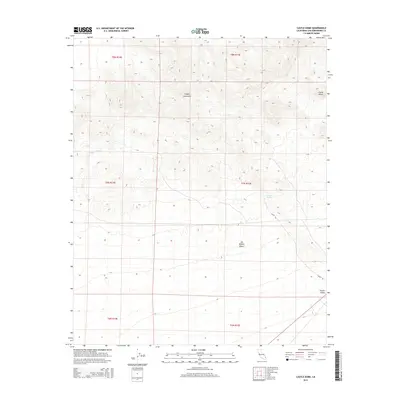
2015 Map of Castle Dome
USGS Topo · Published 2015About this map
Castle Dome rises as a prominent landmark within the Clipper Mountains, dominating this high-desert landscape in eastern San Bernardino County. This 2015 survey illustrates a rugged portion of the Mojave Desert characterized by wide drainage patterns and isolated water sources. Significant topographic relief is defined by the peak and its surrounding ridges, which give way to the broader Fenner Valley in the southeast. The map documents sparse but critical infrastructure in this arid environment, specifically the course of Danby Rd as it skirts the mountain range. Hydrological features such as Clipper Wash and the isolated Bonanza Spring point to the geographic factors that dictated travel and survival in this region. This modern topographic record captures the area's transition from the steep volcanic terrain of the mountains to the alluvial plains of the valley floor.
Find a feature on this map
13 named features on this map. Tap any name to fly to it.
Don’t see what you’re looking for? This feature index may not catch every label — zoom into the map to look around manually.
Map Details
Editions of this 2015 Castle Dome Map
This is the sole edition of this map. No revisions or reprints were ever made.
Other maps of this area

1942 · Amboy
USGS Topo · 1:250,000

1943 · Amboy
USGS Topo · 1:250,000

1943 · Danby
USGS Topo · 1:62,500

1954 · Needles
USGS Topo · 1:250,000

1956 · Needles
USGS Topo · 1:250,000

1956 · Colton Well
USGS Topo · 1:62,500

1956 · Cadiz
USGS Topo · 1:62,500

1956 · Danby
USGS Topo · 1:62,500

1956 · Flynn
USGS Topo · 1:62,500

1981 · Needles
USGS Topo · 1:250,000