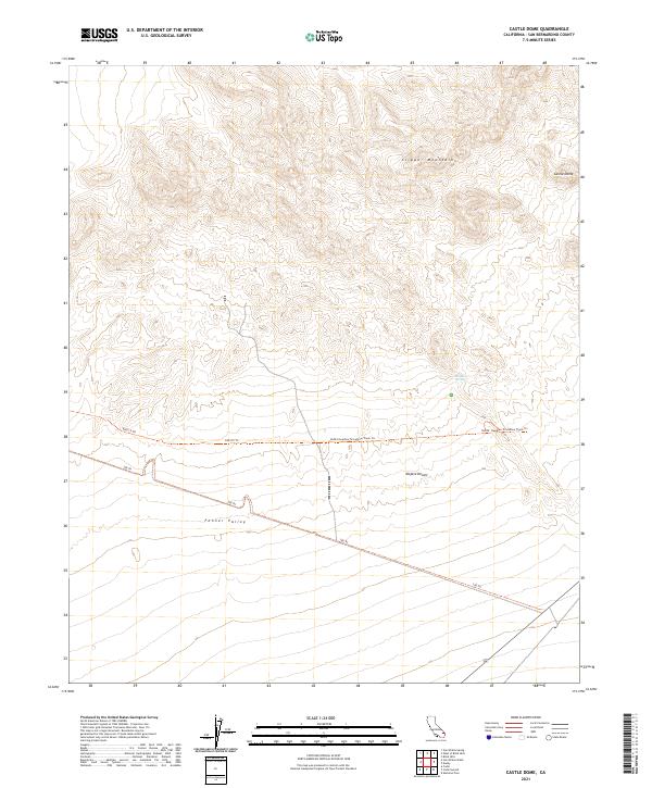
2021 Map of Castle Dome
USGS Topo · Published 2021About this map
Clipper Mountains dominate the northern terrain of this San Bernardino County landscape, rising sharply above the southern expanse of the Mojave Desert. The eponymous Castle Dome stands as a prominent landmark in the northeast corner, overlooking a network of utility and transport routes that traverse the desert floor. Water is a scarce and vital element here, represented by the isolated Bonanza Spring located at the mountain's edge. Below the high peaks, the Fenner Valley opens into a broad alluvial plain, where long-distance tracks like the Ns203: Needles To Ludlow Truck Trl and the 100 Trl reflect the historical and modern reliance on established desert crossings. This survey captures a rugged corner of California where the transition from high peaks to flat desert basins dictates the path of every trail and the location of every rare water source.
Find a feature on this map
14 named features on this map. Tap any name to fly to it.
Don’t see what you’re looking for? This feature index may not catch every label — zoom into the map to look around manually.
Map Details
Editions of this 2021 Castle Dome Map
This is the sole edition of this map. No revisions or reprints were ever made.
Other maps of this area

1942 · Amboy
USGS Topo · 1:250,000

1943 · Amboy
USGS Topo · 1:250,000

1943 · Danby
USGS Topo · 1:62,500

1954 · Needles
USGS Topo · 1:250,000

1956 · Needles
USGS Topo · 1:250,000

1956 · Colton Well
USGS Topo · 1:62,500

1956 · Cadiz
USGS Topo · 1:62,500

1956 · Danby
USGS Topo · 1:62,500

1956 · Flynn
USGS Topo · 1:62,500

1981 · Needles
USGS Topo · 1:250,000