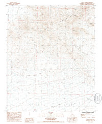
1985 Map of Castle Dome
USGS Topo · Published 1985About this map
Clipper Mountains dominate the high ground of this Mojave Desert landscape, transitioning into the broad expanse of Fenner Valley to the south. The 1985 survey captures a region defined by its vital water sources, including the isolated Van Winkle Spring and Bonanza Spring, which served as critical landmarks for travelers and prospectors in the arid basin. Evidence of resource exploration is scattered throughout the hills, with several sites simply marked Prospect indicating the mineral interest that persisted into the late twentieth century.
Find a feature on this map
11 named features on this map. Tap any name to fly to it.
Don’t see what you’re looking for? This feature index may not catch every label — zoom into the map to look around manually.
Map Details
Editions of this 1985 Castle Dome Map
This is the sole edition of this map. No revisions or reprints were ever made.
Other maps of this area

1942 · Amboy
USGS Topo · 1:250,000

1943 · Amboy
USGS Topo · 1:250,000

1943 · Danby
USGS Topo · 1:62,500

1954 · Needles
USGS Topo · 1:250,000

1956 · Needles
USGS Topo · 1:250,000

1956 · Colton Well
USGS Topo · 1:62,500

1956 · Cadiz
USGS Topo · 1:62,500

1956 · Danby
USGS Topo · 1:62,500

1956 · Flynn
USGS Topo · 1:62,500

1981 · Needles
USGS Topo · 1:250,000