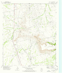
1974 Map of Castle Gap
USGS Topo · Published 1977About this map
Castle Mountain and the prominent King Mountain plateau dominate this landscape along the Crane and Upton County line. This 1970s survey captures a territory defined by the petroleum industry, with dense clusters of oil wells populating the Mc Elroy Oil Field and the Crane-Cowden Oil Field. The terrain is marked by the legendary Castle Gap, a historic pass used by pioneers and cattle drivers on the Goodnight-Loving Trail, here preserved as Castle Gap Park.
Find a feature on this map
15 named features on this map. Tap any name to fly to it.
Don’t see what you’re looking for? This feature index may not catch every label — zoom into the map to look around manually.
Map Details
Editions of this 1974 Castle Gap Map
This is the sole edition of this map. No revisions or reprints were ever made.
Other maps of this area

1928 · Crane
USGS Topo · 1:125,000

1954 · Pecos
USGS Topo · 1:250,000

1957 · Pecos
USGS Topo · 1:250,000

1971 · McElroy Ranch
USGS Topo · 1:24,000

1971 · Marlboro Canyon
USGS Topo · 1:24,000

1972 · Girvin NE
USGS Topo · 1:24,000
1972 · McCamey North
USGS Topo · 1:24,000
1972 · Girvin NW
USGS Topo · 1:24,000

1974 · Crane SW
USGS Topo · 1:24,000
1974 · Crane
USGS Topo · 1:24,000