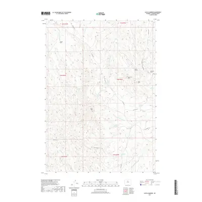
2017 Map of Castle Gardens
USGS Topo · Published 2017About this map
Castle Gardens and its surrounding badlands define this portion of Washakie County, where a complex network of ephemeral drainages and human-made water management features punctuate the arid landscape. The area is marked by prominent geological elevations such as Wild Horse Butte and North Butte, while the drainage of Big Cottonwood Cr and Wild Horse Cr shape the local topography. This 2017 survey shows the reliance on scattered water storage in this ranching country, identified by names like Waitness Corner Reservoir, Chess Reservoir, and Roughs Reservoir. Navigated by local routes including Blue Bank Rd and Teepee Pole Rd, the region maintains its character as a remote expanse of the Bighorn Basin, where features like Hubble Draw and Teepee Pole Draw trace the ancient paths of runoff through the Wyoming soil.
Find a feature on this map
32 named features on this map. Tap any name to fly to it.
Don’t see what you’re looking for? This feature index may not catch every label — zoom into the map to look around manually.
Map Details
Editions of this 2017 Castle Gardens Map
This is the sole edition of this map. No revisions or reprints were ever made.
Other maps of this area

1899 · Cloud peak
USGS Topo · 1:125,000

1901 · Cloud Peak
USGS Topo · 1:125,000

1955 · Sheridan
USGS Topo · 1:250,000

1955 · Arminto
USGS Topo · 1:250,000

1958 · Sheridan
USGS Topo · 1:250,000

1958 · Arminto
USGS Topo · 1:250,000

1962 · Sheridan
USGS Topo · 1:250,000

1962 · Arminto
USGS Topo · 1:250,000

1966 · Deadline Draw
USGS Topo · 1:24,000

1966 · Indian Creek
USGS Topo · 1:24,000