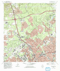
1992 Map of Castle Hills
USGS Topo · Published 1993About this map
San Antonio expands northward into the hills of Bexar County on this map, showing the rapid development of suburban enclaves like Castle Hills and Hill Country Village. The landscape is a mix of residential growth and industrial utility, characterized by large Quarry operations and a Conveyor system near Beckmann. Education and healthcare centers are prominent, notably the University of Texas at San Antonio campus and the sprawling SW Texas Medical Center complex near Ninemile Hill.
Find a feature on this map
63 named features on this map. Tap any name to fly to it.
Don’t see what you’re looking for? This feature index may not catch every label — zoom into the map to look around manually.
Map Details
Editions of this 1992 Castle Hills Map
2 editions found
Other maps of this area

1953 · Otis Ridge
USGS Topo · 1:24,000

1953 · Culebra Hill
USGS Topo · 1:24,000

1953 · San Antonio West
USGS Topo · 1:24,000

1953 · Bulverde
USGS Topo · 1:24,000

1953 · San Antonio East
USGS Topo · 1:24,000

1953 · Longhorn
USGS Topo · 1:24,000

1953 · Helotes
USGS Topo · 1:24,000

1953 · Castle Hills
USGS Topo · 1:24,000

1953 · Van Raub
USGS Topo · 1:24,000

1954 · San Antonio
USGS Topo · 1:250,000