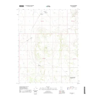
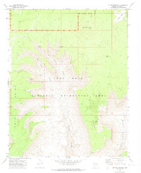
2018 Map of Castle Peak
USGS Topo · Published 2018About this map
Castle Peak rises as the central landmark in this high-desert region of Mohave County, where the landscape is defined by the complex drainage systems of the Parashant Wash. The terrain transitions from the broad, flat expanses of McDonald Flat and Penn Valley into more deeply carved features like Andrus Canyon and Snap Draw. Small-scale settlement is represented by Oak Grove, situated among a network of rural roads such as RD 103 that connect the area's vital water sources.
Find a feature on this map
24 named features on this map. Tap any name to fly to it.
Don’t see what you’re looking for? This feature index may not catch every label — zoom into the map to look around manually.
Map Details
Editions of this 2018 Castle Peak Map
This is the sole edition of this map. No revisions or reprints were ever made.
Other maps of this area

1886 · Mt. Trumbull
USGS Topo · 1:250,000

1892 · Mt. Trumbull
USGS Topo · 1:250,000

1953 · Grand Canyon
USGS Topo · 1:250,000

1957 · Grand Canyon
USGS Topo · 1:250,000

1958 · Grand Canyon
USGS Topo · 1:250,000

1960 · Grand Canyon
USGS Topo · 1:250,000
1967 · Yellow John Mtn.
USGS Topo · 1:24,000
1967 · Whitmore Point SW
USGS Topo · 1:24,000
1971 · Castle Peak
USGS Topo · 1:24,000
1971 · Mt. Dellenbaugh
USGS Topo · 1:24,000