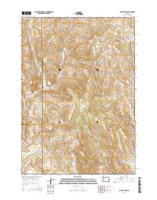
2014 Map of Castle Rock
USGS Topo · Published 2014About this map
The Little Malheur River winds through the high desert landscape of this quadrangle, defining the western reaches near Black Butte. This remote region of eastern Oregon is characterized by a network of drainage systems and isolated water sources, where the Lost Creek Rd and Rose Creek Rd provide rare access through the rugged elevation. The map shows the convergence of three counties—Grant, Malheur, and Harney—meeting in a series of surveyed boundaries across the high plateaus.
Find a feature on this map
31 named features on this map. Tap any name to fly to it.
Don’t see what you’re looking for? This feature index may not catch every label — zoom into the map to look around manually.
Map Details
Editions of this 2014 Castle Rock Map
This is the sole edition of this map. No revisions or reprints were ever made.
Other maps of this area

1908 · Ironside Mountain
USGS Topo · 1:125,000

1955 · Burns
USGS Topo · 1:250,000

1955 · Canyon City
USGS Topo · 1:250,000

1958 · Burns
USGS Topo · 1:250,000

1959 · Burns
USGS Topo · 1:250,000

1959 · Canyon City
USGS Topo · 1:250,000

1966 · Beulah
USGS Topo · 1:62,500

1968 · Drewsey
USGS Topo · 1:62,500

1970 · Flag Prairie
USGS Topo · 1:62,500

1970 · Castle Rock
USGS Topo · 1:62,500