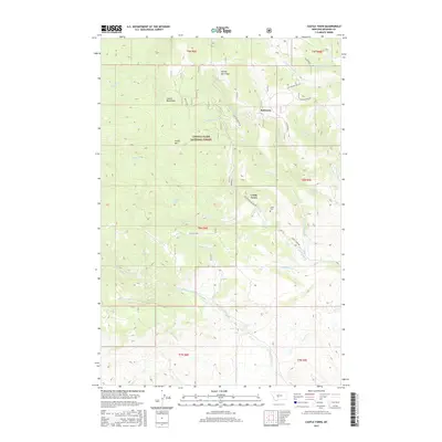
2017 Map of Castle Town
USGS Topo · Published 2017About this map
Castle Town and the nearby settlement of Robinson occupy a high-elevation landscape within the Lewis & Clark National Forest. This 2017 survey details a terrain defined by steep ridges and drainages, including Chicken Ridge and Yankee Jim Ridge. For genealogists and local historians, the Castle Cem sits just north of the namesake townsite, while family-named waterways like Albaugh Cr and Reynolds Cr carve through the mountains. The area's legacy of early Montana industry is hinted at by features such as Slaughterhouse Cr and the network of forest roads like Nat For Dev Rd 581 and the Castle Town Rd that connect these remote locations to the higher peaks of Castle Mtn.
Find a feature on this map
33 named features on this map. Tap any name to fly to it.
Don’t see what you’re looking for? This feature index may not catch every label — zoom into the map to look around manually.
Map Details
Editions of this 2017 Castle Town Map
This is the sole edition of this map. No revisions or reprints were ever made.
Other maps of this area

1886 · Little Belt Mts.
USGS Topo · 1:250,000

1894 · Little Belt Mts.
USGS Topo · 1:250,000

1897 · Little Belt Mts.
USGS Topo · 1:250,000

1898 · Little Belt Mts.
USGS Topo · 1:250,000

1902 · Little Belt Mts.
USGS Topo · 1:250,000

1948 · White Sulphur Springs
USGS Topo · 1:250,000

1951 · Hamen
USGS Topo · 1:24,000
1951 · Ringling
USGS Topo · 1:24,000

1951 · Rimrock Divide
USGS Topo · 1:24,000

1958 · White Sulphur Springs
USGS Topo · 1:250,000