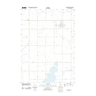
2012 Map of Castlewood
USGS Topo · Published 2012About this map
Castlewood serves as the primary hub of this eastern South Dakota landscape, situated along the winding banks of the Big Sioux River. This 2012 depiction reveals a structured grid of agricultural section lines and townships, where roads like 455th Ave and 184th St provide the framework for the rural Hamlin County economy. In the southern reaches of the quadrangle, the expansive waters of Lake Poinsett and the adjacent Lake Florence dominate the terrain, illustrating the glacial hydrology characteristic of the region. The map captures local landmarks such as Kones Corner and the central Po in Castlewood, while the detailed street-level mapping of E Main St and Alice St offers a clear view of the town's residential and commercial core during the early twenty-first century.
Find a feature on this map
32 named features on this map. Tap any name to fly to it.
Don’t see what you’re looking for? This feature index may not catch every label — zoom into the map to look around manually.
Map Details
Editions of this 2012 Castlewood Map
This is the sole edition of this map. No revisions or reprints were ever made.
Other maps of this area

1953 · Watertown
USGS Topo · 1:250,000

1958 · Watertown
USGS Topo · 1:250,000

1969 · Hayti
USGS Topo · 1:24,000

1969 · Dempster
USGS Topo · 1:24,000

1969 · Castlewood
USGS Topo · 1:24,000

1969 · Lake Norden
USGS Topo · 1:24,000

1969 · Pelican Lake
USGS Topo · 1:24,000

1969 · Watertown SE
USGS Topo · 1:24,000

1969 · Lake Poinsett
USGS Topo · 1:24,000

1970 · Kranzburg SW
USGS Topo · 1:24,000