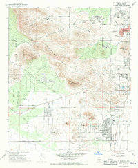
1968 Map of Cat Mountain
USGS Topo · Published 1970About this map
Tucson expands westward into the foothills of the Tucson Mountains in the late 1960s, a period marked by suburban development meeting the edge of Saguaro National Monument. The eastern edge of the sheet captures a dense institutional and residential corridor, including St Marys Hospital, the University of Arizona Geochronology Laboratories, and local schools like Brichta Sch and Sahuaro Sch. The landscape is defined by the sharp transition from the flat valley floor of the Santa Cruz River to the volcanic peaks of Cat Mountain and Golden Gate Mountain. Evidence of early land use and resource extraction appears in scattered prospects and quarries, while modern recreation is represented by the extensive Tucson Mountain County Park and specialized facilities like the Rifle Range and Pistol Range.
Find a feature on this map
55 named features on this map. Tap any name to fly to it.
Don’t see what you’re looking for? This feature index may not catch every label — zoom into the map to look around manually.
Map Details
Editions of this 1968 Cat Mountain Map
2 editions found
Other maps of this area

1904 · Tucson
USGS Topo · 1:125,000

1905 · Tucson
USGS Topo · 1:125,000

1925 · San Xavier
USGS Topo · 1:62,500

1934 · Tucson Mountains
USGS Topo · 1:125,000

1943 · San Xavier Mission
USGS Topo · 1:62,500

1947 · Cortaro
USGS Topo · 1:62,500

1948 · Tucson
USGS Topo · 1:62,500

1956 · Tucson
USGS Topo · 1:250,000

1957 · San Xavier Mission
USGS Topo · 1:62,500

1957 · Tucson
USGS Topo · 1:24,000