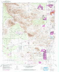
1968 Map of Cat Mountain
USGS Topo · Published 1977About this map
The Tucson Mountains rise sharply in this late-1960s survey, illustrating the desert landscape just before significant suburban sprawl began to move westward from Tucson. The western edge of the city is centered around medical and academic institutions such as St Marys Hospital and the University of Arizona Geochronology Laboratories, while the rugged terrain to the west remains largely preserved within Tucson Mountain Park. This survey captures the transition from urban density to desert wilderness, marked by notable peaks like Golden Gate Mountain and the strategic Gates Pass.
Find a feature on this map
51 named features on this map. Tap any name to fly to it.
Don’t see what you’re looking for? This feature index may not catch every label — zoom into the map to look around manually.
Map Details
Editions of this 1968 Cat Mountain Map
2 editions found
Other maps of this area

1904 · Tucson
USGS Topo · 1:125,000

1905 · Tucson
USGS Topo · 1:125,000

1925 · San Xavier
USGS Topo · 1:62,500

1934 · Tucson Mountains
USGS Topo · 1:125,000

1943 · San Xavier Mission
USGS Topo · 1:62,500

1947 · Cortaro
USGS Topo · 1:62,500

1948 · Tucson
USGS Topo · 1:62,500

1956 · Tucson
USGS Topo · 1:250,000

1957 · San Xavier Mission
USGS Topo · 1:62,500

1957 · Tucson
USGS Topo · 1:24,000