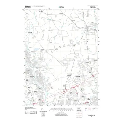
2010 Map of Catasauqua
USGS Topo · Published 2010About this map
Hokendauqua Creek and the Lehigh River define the industrial and residential corridors of this Lehigh Valley landscape at the start of the 2010s. The dense borough of Catasauqua sits at the heart of a cluster of historic communities including Hokendauqua, Coplay, and North Catasauqua, where numerous religious and community landmarks such as Saint Andrews Cemetery and Calvary Cemetery are concentrated. To the north and east, the terrain opens into a patchwork of smaller hamlets like Seemsville and Howertown, separated by elevations like Sauerkraut Hill. The region's industrial heritage is evidenced by the proximity of Cement Junction and Crane Junction, while modern infrastructure is represented by Martin Airport and the sprawling Cedar Hill Memorial Park near Fullerton.
Find a feature on this map
135 named features on this map. Tap any name to fly to it.
Don’t see what you’re looking for? This feature index may not catch every label — zoom into the map to look around manually.
Map Details
Editions of this 2010 Catasauqua Map
This is the sole edition of this map. No revisions or reprints were ever made.
Other maps of this area

1894 · Allentown
USGS Topo · 1:62,500

1902 · Slatington
USGS Topo · 1:62,500

1914 · Wind Gap
USGS Topo · 1:62,500

1916 · Wind Gap
USGS Topo · 1:62,500

1922 · Mauch Chunk
USGS Topo · 1:62,500

1924 · Mauch Chunk
USGS Topo · 1:62,500

1937 · Allentown West
USGS Topo · 1:48,000

1939 · Allentown
USGS Topo · 1:62,500

1942 · Allentown West
USGS Topo · 1:62,500

1943 · Mauch Chunk
USGS Topo · 1:62,500