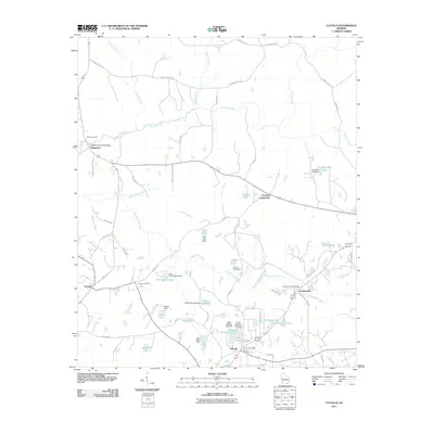
2011 Map of Cataula
USGS Topo · Published 2011About this map
Mulberry Creek and its many tributaries, including Ossahatchie Creek and Turntime Branch, define the topography of this Harris County landscape. The region's transport history is remarkably preserved through its traditional creek crossings, notably the Kingsboro Covered Bridge near Kingsboro and the Lowes Covered Bridge further east. These structures, alongside the presence of the Ellerslie Post Office and multiple family-named burial grounds like Bruce Cemetery and Clowers Cemetery, reflect a deeply established rural community structure.
Find a feature on this map
72 named features on this map. Tap any name to fly to it.
Don’t see what you’re looking for? This feature index may not catch every label — zoom into the map to look around manually.
Map Details
Editions of this 2011 Cataula Map
This is the sole edition of this map. No revisions or reprints were ever made.
Other maps of this area

1907 · Talbotton
USGS Topo · 1:125,000

1934 · Warm Springs
USGS Topo · 1:62,500

1936 · Warm Springs
USGS Topo · 1:62,500

1949 · Midland
USGS Topo · 1:24,000

1949 · Upatoi
USGS Topo · 1:24,000

1950 · Fortson
USGS Topo · 1:24,000

1950 · Mulberry Grove
USGS Topo · 1:24,000

1950 · Waverly Hall
USGS Topo · 1:24,000

1950 · Cataula
USGS Topo · 1:24,000

1950 · Talbotton
USGS Topo · 1:62,500