
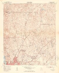
1950 Map of Fortson
USGS Topo · Published 1953About this map
Columbus expansion and mid-century industrial development characterize this 1950s survey of northern Muscogee County. The northern reaches maintain a rural character centered on Fortson and Nankipooh, defined by a network of country schools and churches such as Nancy Sch, Mount Gillion Ch, and Pierce Chapel. The transition toward the city is evident as residential areas like Green Island Hills and Crystal Valley begin to emerge near established infrastructure like the Muscogee County Airport.
Find a feature on this map
43 named features on this map. Tap any name to fly to it.
Don’t see what you’re looking for? This feature index may not catch every label — zoom into the map to look around manually.
Map Details
Editions of this 1950 Fortson Map
2 editions found
Other maps of this area

1907 · Talbotton
USGS Topo · 1:125,000

1907 · Opelika
USGS Topo · 1:125,000

1908 · Columbus
USGS Topo · 1:62,500

1909 · Opelika
USGS Topo · 1:125,000

1914 · Seale
USGS Topo · 1:62,500

1929 · Columbus
USGS Topo · 1:48,000

1947 · Columbus
USGS Topo · 1:62,500

1949 · Midland
USGS Topo · 1:24,000

1949 · Ochillee
USGS Topo · 1:24,000

1949 · Columbus
USGS Topo · 1:24,000