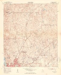
1950 Map of Fortson
USGS Topo · Published 1953About this map
Columbus anchors the southern portion of this mid-century survey, showing the city's northward expansion into the surrounding rural uplands of Muscogee Co. The landscape is a mix of developing residential areas like Green Island Hills and traditional rural landmarks, including numerous small country churches such as Getzen Ch and Pierce Chapel. The Muscogee County Airport and the Columbus Speedway highlight the era's growing infrastructure and recreational interests.
Find a feature on this map
49 named features on this map. Tap any name to fly to it.
Don’t see what you’re looking for? This feature index may not catch every label — zoom into the map to look around manually.
Map Details
Editions of this 1950 Fortson Map
2 editions found

Other maps of this area

1907 · Talbotton
USGS Topo · 1:125,000

1907 · Opelika
USGS Topo · 1:125,000

1908 · Columbus
USGS Topo · 1:62,500

1909 · Opelika
USGS Topo · 1:125,000

1914 · Seale
USGS Topo · 1:62,500

1929 · Columbus
USGS Topo · 1:48,000

1947 · Columbus
USGS Topo · 1:62,500

1949 · Midland
USGS Topo · 1:24,000

1949 · Ochillee
USGS Topo · 1:24,000

1949 · Columbus
USGS Topo · 1:24,000