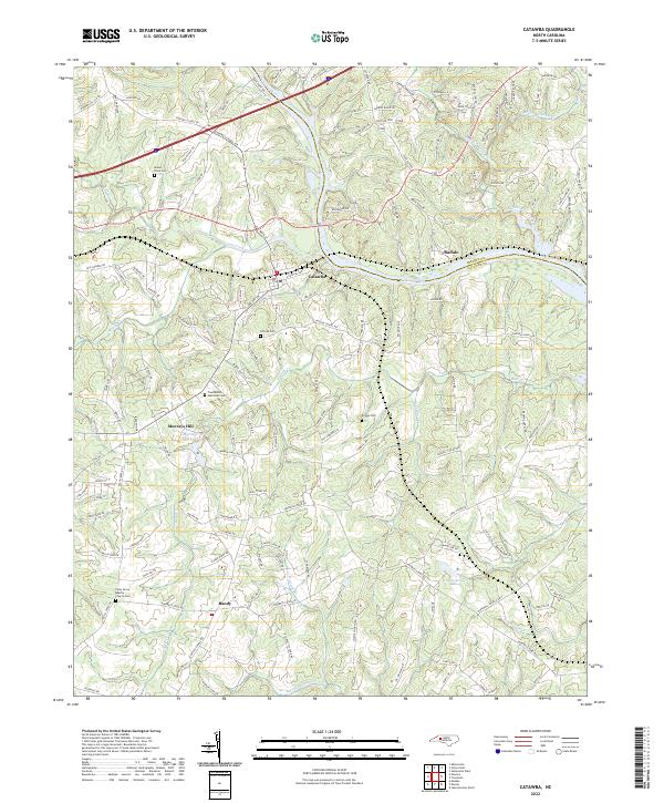
2022 Map of Catawba
USGS Topo · Published 2022About this map
Catawba serves as the focal point for this landscape where the NS railroad line crosses the northern reaches of the Catawba River. The terrain is defined by a dense network of tributaries including Lyle Cr, Balls Cr, and Gold Mine Cr that drain into the widening waters of Lake Norman along the Iredell and Catawba County line. The rural character of the region is punctuated by family and community landmarks such as Murrays Hill and Murrays Mill Lake.
Find a feature on this map
147 named features on this map. Tap any name to fly to it.
Don’t see what you’re looking for? This feature index may not catch every label — zoom into the map to look around manually.
Map Details
Editions of this 2022 Catawba Map
This is the sole edition of this map. No revisions or reprints were ever made.
Other maps of this area

1893 · Statesville
USGS Topo · 1:125,000

1895 · Hickory
USGS Topo · 1:125,000

1953 · Charlotte
USGS Topo · 1:250,000

1954 · Charlotte
USGS Topo · 1:250,000

1960 · Charlotte
USGS Topo · 1:250,000

1962 · Charlotte
USGS Topo · 1:250,000

1969 · Troutman
USGS Topo · 1:24,000

1969 · Statesville West
USGS Topo · 1:24,000
1970 · Maiden
USGS Topo · 1:24,000
1970 · Lake Norman North
USGS Topo · 1:24,000