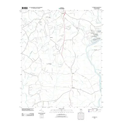
2011 Map of Catawba
USGS Topo · Published 2011About this map
Harmony and Catawba anchor this landscape along the western banks of the Catawba River in the early 21st century. The terrain is defined by a dense network of tributaries including Greene Creek, Abernathy Creek, and Tinkers Creek, which feature several water control structures such as Tinkers Creek WCD Dam Number 21. These creeks carve through the land before joining the main river channel, where Culp Island and the crossing at Lands Ford mark significant points of geographic interest.
Find a feature on this map
132 named features on this map. Tap any name to fly to it.
Don’t see what you’re looking for? This feature index may not catch every label — zoom into the map to look around manually.
Map Details
Editions of this 2011 Catawba Map
This is the sole edition of this map. No revisions or reprints were ever made.
Other maps of this area

1941 · Spartanburg
USGS Topo · 1:250,000

1949 · Rock Hill
USGS Topo · 1:62,500

1953 · Spartanburg
USGS Topo · 1:250,000

1960 · Spartanburg
USGS Topo · 1:250,000

1963 · Spartanburg
USGS Topo · 1:250,000

1964 · Spartanburg
USGS Topo · 1:250,000

1968 · Van Wyck
USGS Topo · 1:24,000

1968 · Catawba
USGS Topo · 1:24,000
1968 · Catawba NE
USGS Topo · 1:24,000
1968 · Rock Hill East
USGS Topo · 1:24,000