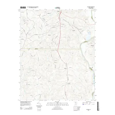
2014 Map of Catawba
USGS Topo · Published 2014About this map
The Catawba River defines the eastern boundary of this South Carolina landscape, serving as a historic dividing line between York, Lancaster, and Chester Counties. This survey illustrates the transition from the upland communities of Lesslie and Harmony down to the riverbanks where Lands Ford and the settlement of Landsford reflect the area’s long-standing connection to river crossings and early commerce. The terrain is deeply dissected by numerous watercourses, including Tinkers Cr, Fishing Creek, and Abernathy Cr, which shape the local road network and land use patterns.
Find a feature on this map
128 named features on this map. Tap any name to fly to it.
Don’t see what you’re looking for? This feature index may not catch every label — zoom into the map to look around manually.
Map Details
Editions of this 2014 Catawba Map
This is the sole edition of this map. No revisions or reprints were ever made.
Other maps of this area

1941 · Spartanburg
USGS Topo · 1:250,000

1949 · Rock Hill
USGS Topo · 1:62,500

1953 · Spartanburg
USGS Topo · 1:250,000

1960 · Spartanburg
USGS Topo · 1:250,000

1963 · Spartanburg
USGS Topo · 1:250,000

1964 · Spartanburg
USGS Topo · 1:250,000

1968 · Van Wyck
USGS Topo · 1:24,000

1968 · Catawba
USGS Topo · 1:24,000
1968 · Catawba NE
USGS Topo · 1:24,000
1968 · Rock Hill East
USGS Topo · 1:24,000