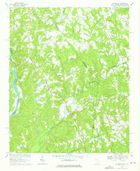
1968 Map of Catawba NE
USGS Topo · Published 1975About this map
The Catawba River and Sugar Creek define the western edge of this landscape, carving through the Piedmont along the border of York and Lancaster Counties. In the late 1960s, this region remained predominantly rural, characterized by a network of country churches such as Belair Ch, Indian Land Ch, and Heath Memorial Ch. The settlement of Marvin sits near the northern boundary, while the Seaboard Coast Line railroad cuts diagonally across the terrain toward Waxhaw.
Find a feature on this map
53 named features on this map. Tap any name to fly to it.
Don’t see what you’re looking for? This feature index may not catch every label — zoom into the map to look around manually.
Map Details
Editions of this 1968 Catawba NE Map
4 editions found
Other maps of this area

1905 · Charlotte
USGS Topo · 1:48,000

1907 · Charlotte
USGS Topo · 1:62,500

1941 · Charlotte
USGS Topo · 1:125,000

1941 · Spartanburg
USGS Topo · 1:250,000

1942 · Charlotte
USGS Topo · 1:125,000

1953 · Spartanburg
USGS Topo · 1:250,000

1953 · Charlotte
USGS Topo · 1:250,000

1954 · Charlotte
USGS Topo · 1:250,000

1960 · Charlotte
USGS Topo · 1:250,000

1960 · Spartanburg
USGS Topo · 1:250,000