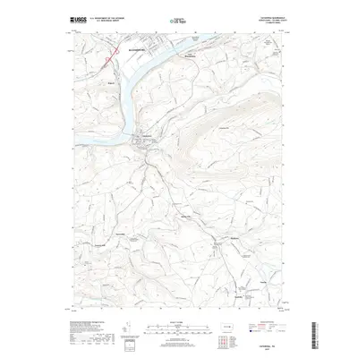
2019 Map of Catawissa
USGS Topo · Published 2019About this map
The Susquehanna River bends sharply through this Columbia County landscape, serving as the historical anchor for Bloomsburg and its smaller neighbors. Industry and agriculture converge along the waterways, where the legacies of milling operations are preserved at Parrs Mill and Pensyls Mill on the banks of Roaring Creek. The town of Catawissa serves as a central hub, situated at the confluence of the river and Catawissa Creek, while smaller settlements like Slabtown and Rupert reflect the distributed development patterns of the region. Local history is deeply etched into the topography, from the heights of Catawissa Mtn to the quiet grounds of Saint Pauls United Methodist Church Cem and Mount Zion Cem. The presence of the Norfolk Southern rail line and various forest roads, including those managed by the state, highlights the area's ongoing role in transportation and timber management.
Find a feature on this map
130 named features on this map. Tap any name to fly to it.
Don’t see what you’re looking for? This feature index may not catch every label — zoom into the map to look around manually.
Map Details
Editions of this 2019 Catawissa Map
This is the sole edition of this map. No revisions or reprints were ever made.
Other maps of this area

1889 · Catawissa
USGS Topo · 1:62,500

1892 · Catawissa
USGS Topo · 1:62,500

1892 · Shamokin
USGS Topo · 1:62,500

1893 · Shamokin
USGS Topo · 1:62,500

1894 · Catawissa
USGS Topo · 1:62,500

1894 · Bloomsburg
USGS Topo · 1:62,500

1935 · Hughesville
USGS Topo · 1:62,500

1943 · Shamokin
USGS Topo · 1:62,500

1947 · Bloomsburg
USGS Topo · 1:24,000

1947 · Ashland
USGS Topo · 1:24,000
Featured Places
- Bloomsburg, PA
- Scott Township, PA
- Numidia, Locust Township
- East Bloomsburg, Catawissa Township
- Locust Township, PA