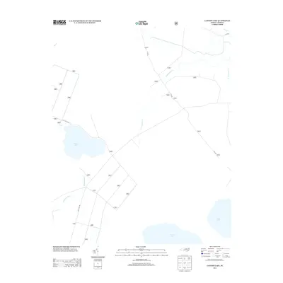
2013 Map of Catfish Lake
USGS Topo · Published 2013About this map
Catfish Lake and its surrounding wetlands dominate this coastal Carolina landscape, which is defined by a dense network of swampy tributaries and drainage canals. The map illustrates a primarily agricultural and forested environment, with the W Prong Brice Cr and E Prong Brice Cr feeding into Brice Cr as it winds north. Evidence of regional rural development is clear through the geometric patterns of forest access roads like Black Swamp Rd and Cat Fish Farm Rd, as well as numbered service roads such as 3011, 3012, and 3013 south of the main lake. To the southeast, the expansive shores of Great Lake and Long Lake hint at the vast hydrologic systems that characterize this part of Craven County. The absence of traditional town centers highlights the area's role as a managed natural resource area, where drainage and forest management dictate the layout of the land.
Find a feature on this map
31 named features on this map. Tap any name to fly to it.
Don’t see what you’re looking for? This feature index may not catch every label — zoom into the map to look around manually.
Map Details
Editions of this 2013 Catfish Lake Map
This is the sole edition of this map. No revisions or reprints were ever made.
Other maps of this area

1901 · New Bern
USGS Topo · 1:62,500

1903 · New Bern
USGS Topo · 1:62,500

1942 · Maysville
USGS Topo · 1:62,500

1948 · Maysville
USGS Topo · 1:62,500

1949 · Havelock
USGS Topo · 1:24,000

1949 · Masontown
USGS Topo · 1:24,000

1950 · Pollocksville
USGS Topo · 1:24,000

1950 · New Bern
USGS Topo · 1:24,000

1950 · Upper Broad Creek
USGS Topo · 1:24,000

1951 · Masontown
USGS Topo · 1:24,000